🌎 Mission: To strengthen communities and businesses through an on-demand Autonomous Aerial Intelligence network for routine inspections and swift response.
🚀 Strategy: Start with (1) high-margin drone sales, (2) reinvest in autonomous infrastructure, then (3) scale into a service-led model and (4) monetize the network’s aerial data through a digital twin model.
Stage 1 – TerraHawk: Large-Scale Mapping and inspections
🌐 Enter the professional drone market by offering a survey-grade photogrammetry UAV that outperforms incumbents on a performance-per-dollar basis by a factor of two.
Problem
- Traditional survey-grade drones are costly and inaccessible for SMEs and freelance professionals (the majority of the market).
Execution
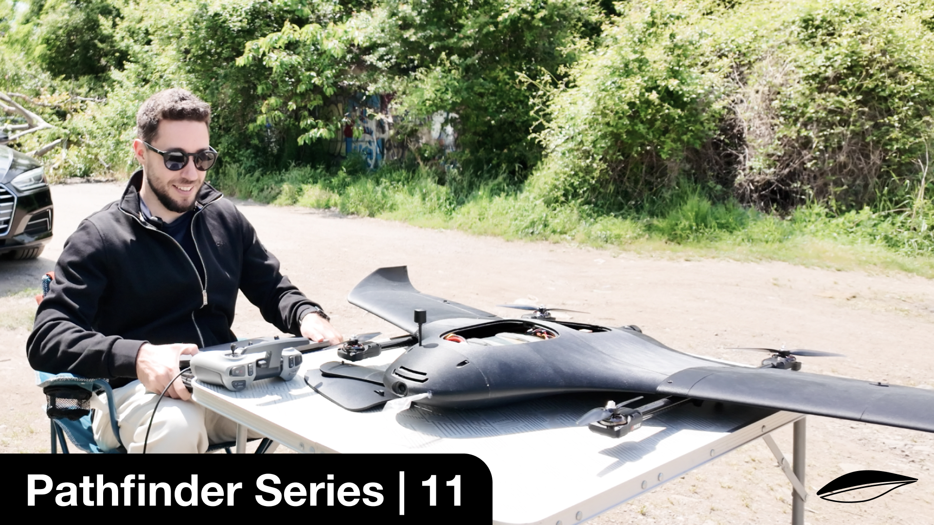
- Launch TerraHawk, a C2 & C6-certified UAV with 3–4 hour endurance and modular payloads (photogrammetry cameras, AI sensors).
- Proprietary 3D-printed airframes and direct-to-customer distribution reduce system cost by ~50% versus comparable platforms (Wingtra, eBee X, Trinity).
- Initial focus on price-sensitive regions such as the Balkans, addressing a €7.5–15M serviceable market.
Market Opportunity
- Global drone mapping market: USD 1.3B in 2025, growing at 17% CAGR to 2035.
- Europe’s 3D mapping & modelling market: USD 2.96B (2024) → USD 9.81B by 2033.
- Demand driven by land surveying, construction, agriculture, and environmental monitoring.
Outcome
- Early sales generate cash flow and real-world feedback while validating engineering.
- Profits fund autonomous infrastructure development in Stage 2.
Stage 2 – terrapod: Fully Autonomous Inspection
🔍 Transition from drone sales to subscription-driven infrastructure by delivering fully autonomous inspection drones housed in "TerraPod" Robo-Hangars, eliminating the need for licensed pilots.
Problem
- Critical infrastructure requires frequent inspections, but reliance on pilots and helicopters makes this expensive, slow, and risky.
Execution
- Package Pathfinder drones into automated hangars that charge, shelter, and dispatch UAVs autonomously.
- Sell or lease systems to utilities, telecoms, mining, solar, and agricultural operators.
- Customers pay upfront for hardware and subscribe for software, BVLOS compliance, insurance, and remote operations.
- TerraHawk profits fund BVLOS approvals and product maturation.
Market Opportunity
- Drone inspection & monitoring market: USD 13.48B (2024) → USD 31.1B by 2029.
- Inspection drones market: USD 11.75B in 2025, 21.6% CAGR to 2030.
- EU BVLOS and U-Space regulations are maturing and expected to enable scalable operations by Stage 2.
Outcome
- Converts one-time hardware buyers into recurring-revenue clients.
- Each Robo-Hangar becomes a node enabling the on-demand network in Stage 3.
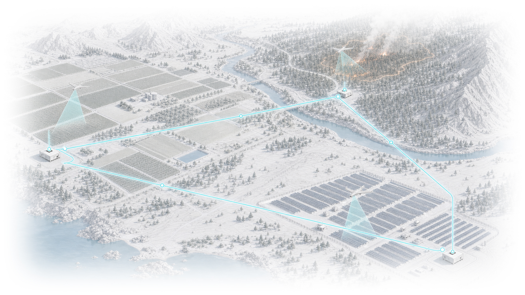
Stage 3 – FarSight: On-Demand Aerial data platform
🌐 Deploy Robo-Hangars into an “Uber for aerial intelligence”—delivering on-demand mapping, inspection, search & rescue, and environmental monitoring without customer CAPEX.
Problem
- Many organizations need aerial data occasionally but cannot justify owning and operating fleets.
Execution
- Customers define area, urgency, and mission via a web interface.
- The nearest hangar dispatches a drone automatically.
- Dynamic pricing reflects urgency; missions are logged and paid via subscription or per-mission fees.
- Initial rollout in BVLOS-approved regions with supportive airspace frameworks.
- Each hangar may function as an investment node with smart-contract revenue sharing (KYC increases overhead).
Market Opportunity
- Commercial drone services market: USD 7.62B (2025) → USD 30.3B by 2035.
- Drone-as-a-Service: USD 6.3B (2024) → USD 27.3B by 2033.
- Service layers consistently outpace hardware growth due to abstraction of ownership.
Outcome
- Generates annuity-like revenue and strong network effects.
- Every new hangar improves coverage, response time, and defensibility.
Stage 4 – Digital Twin Network Effect
🇪🇺 Achieve EU-wide coverage while transforming network-generated data into a high-margin revenue stream.
Problem
- Fragmented and inconsistent aerial data limits planning, resilience, and environmental stewardship.
Execution
- Scale Robo-Hangars across Europe aligned with EASA U-Space and BVLOS frameworks.
- Use decentralized funding (e.g., tokenized ownership) to accelerate deployment.
- Systematically collect, process, anonymize, and index imagery and sensor data from every mission.
Market Opportunity
- Europe 3D mapping & modelling: USD 9.81B by 2033.
- Geospatial analytics: USD 114.32B (2024) → USD 226.53B by 2030.
- Digital twin technologies: USD 21.14B (2025) → USD 149.81B by 2030.
Outcome
- Each new hangar compounds both service revenue and proprietary data value.
- Data monetized via APIs and analytics platforms becomes a defensible, high-margin business line.
A Vision for Impact
Our roadmap is more than a business plan—it’s a commitment to a future where the sky serves society. By democratizing access to high-quality aerial intelligence, we empower communities, governments, and businesses to prevent disasters, optimize infrastructure, and steward natural resources.
Every flight can help a farmer reduce water use, a utility prevent outages, or a rescue team save lives. As the network grows, so does our ability to monitor forests, detect pollution, and map climate-affected regions—forming a living digital twin of our environment.
Technology, transparency, and purpose together can build a safer, cleaner, and more equitable world.
— George Petrov, Founder